|
|
|
|
|
|||
|
NEPAL | ARTICLES | KAVITAHARU | MANTHAN | COOL LINKS | GUESTBOOK | SEARCH |
|||
Map of Nepal : Baglung District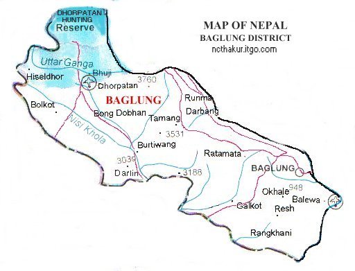
Area: 1784 sq.km Baglung district, a part of Dhaulagiri zone, is one of the seventy-five districts of Nepal. Baglung is the vantage point for trekkers to Mustang, Dolpa and Mt. Dhaulagiri. Baglung has the only hunting reserve in Nepal. Royal Dhorpatan Hunting Reserve is a prime habitat for blue sheep and snow leopard. |
|||
|
Home
| About Me
| Nepal
| Articles
| Kavitaharu
| Cool Links
Javascript | Add Email | Guestbook |
|||
