|
|
|
|
|
|||
|
NEPAL | ARTICLES | KAVITAHARU | MANTHAN | COOL LINKS | GUESTBOOK | SEARCH |
|||
Map of Nepal : Humla District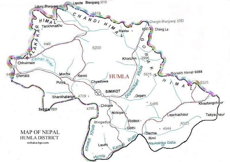
Area: 5655 sq.km Humla district, a part of Karnali zone, is one of the seventy-five districts of Nepal. Simikot is the distirct headquarters of Humla District. Humla is a very remote district of Mid-West Nepal in the north-west corner of the country bordering Tibet. Lack of roads and extremely difficult air access are perhaps the most important constraints to tourism development in the area. |
|||
|
Home
| About Me
| Nepal
| Articles
| Kavitaharu
| Cool Links
Javascript | Add Email | Guestbook |
|||
