|
|
|
|
|
|||
|
NEPAL | ARTICLES | KAVITAHARU | MANTHAN | COOL LINKS | GUESTBOOK | SEARCH |
|||
Map of Nepal : Chitawan District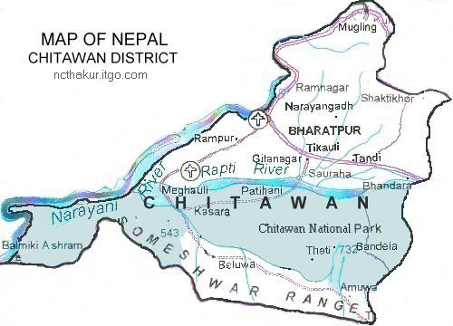
Area: 2218 sq.km The importance of Chitawan District to most visitors is Chitawan National Park which covers 360 sq. miles. The Chitawan Nation Park is accessible from major cities in Nepal both by road and air, with flight to Meghauli and nearby Bharatpur. There are many lodges, camps, and tea houses in and around the sanctuary. Chitawan is best between October and April. |
|||
|
Home
| About Me
| Nepal
| Articles
| Kavitaharu
| Cool Links
Javascript | Add Email | Guestbook |
|||
