|
|
|
|
|
|||
|
NEPAL | ARTICLES | KAVITAHARU | MANTHAN | COOL LINKS | GUESTBOOK | SEARCH |
|||
Map of Nepal : Manang District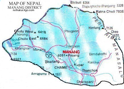
Area: 2246 sq.km Manang district, a part of Gandaki zone, is one of the seventy-five districts of Nepal. Chame is its district headquarters. Manang district consists of 13 villages and is divided into two valleys—the Upper Valley and the Lower Valley—and is home to just about 9,600 people. |
|||
|
Home
| About Me
| Nepal
| Articles
| Kavitaharu
| Cool Links
Javascript | Add Email | Guestbook |
|||
