|
|
|
|
|
|||
|
NEPAL | ARTICLES | KAVITAHARU | MANTHAN | COOL LINKS | GUESTBOOK | SEARCH |
|||
Map of Nepal : Solukhumbu District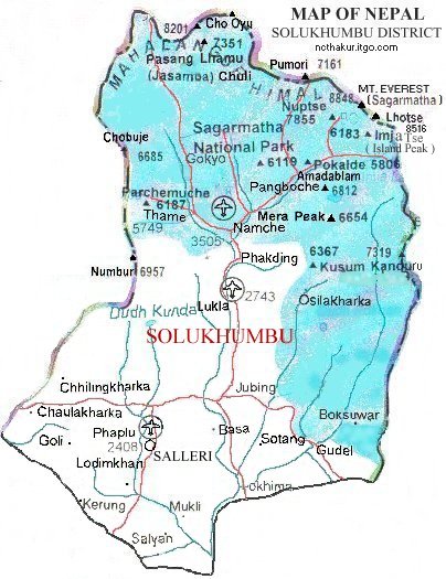
Area: 3480 sq.km Solukhumbhu District, a part of Sagarmatha Zone, is one of the seventy-five districts of Nepal. Including Mt. Everest, many major mounatin peaks lies in this district. Namche, Lukla, Salleri, phaplu are some of the important places. |
|||
|
Home
| About Me
| Nepal
| Articles
| Kavitaharu
| Cool Links
Javascript | Add Email | Guestbook |
|||
